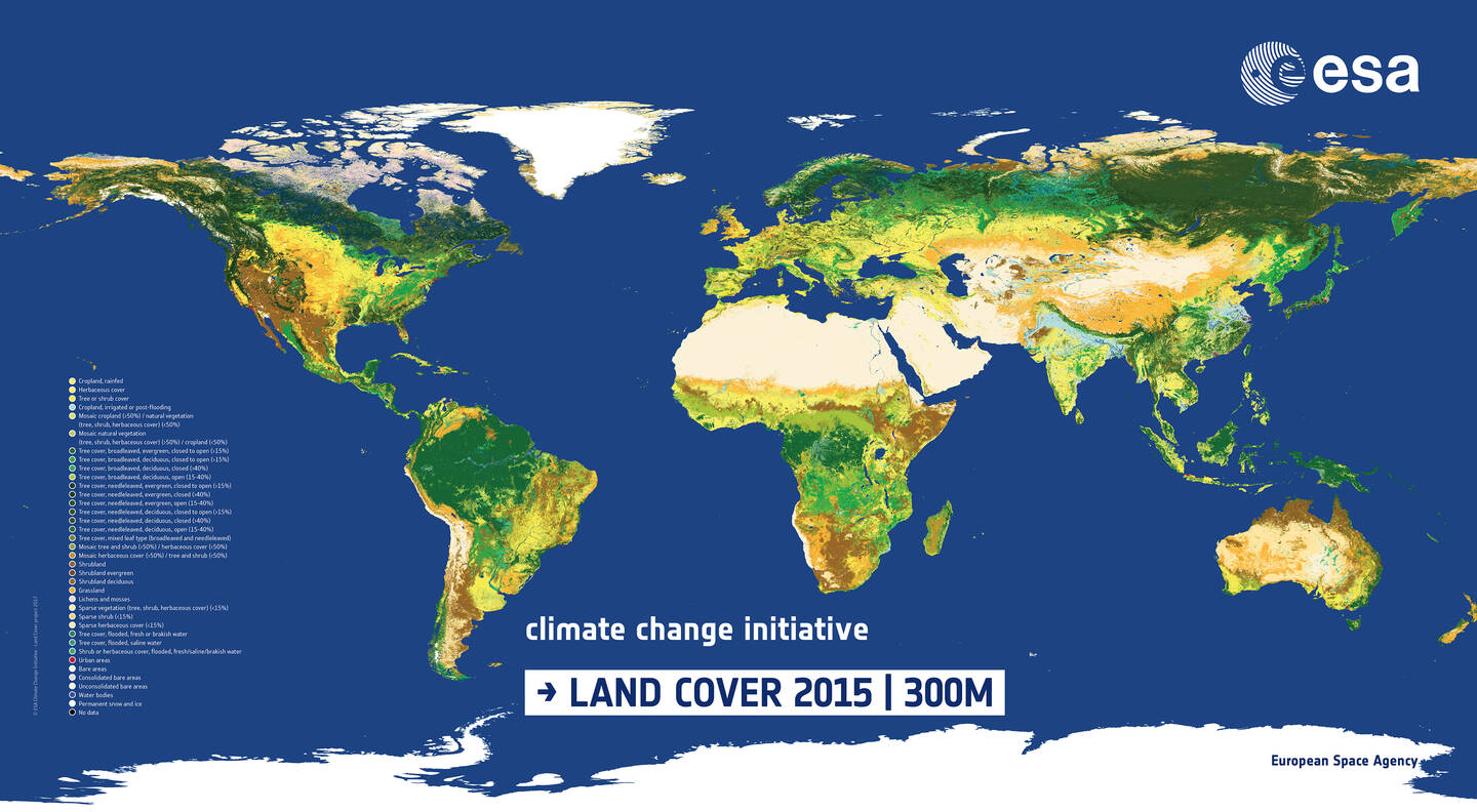
Image created by Envisat’s Medium Resolution Imaging Spectrometer (MERIS) instrument. The GlobCover project is part of ESA’s Earth Observation Data User Element (DUE). An international network of partners has worked with ESA on the project, including the United Nations Environment Programme (UNEP), United Nations Food Agriculture Organisation (FAO), the European Commission’s Joint Research Centre (JRC), the European Environmental Agency (EEA), the International Geosphere-Biosphere Programme (IGBP), and the Global Observations of Forest Cover and Global Observations of Land Dynamics (GOFC-GOLD) Implementation Team Project Office.
Produced in 2017, this global land-cover map is ten times sharper than any previous global satellite map, with a spatial resolution of 300 meters (975 feet). Data in the map are useful for many applications, including modeling climate change extent and impacts, conserving biodiversity, and managing natural resources. The map is available to the public on the European Space Agency (ESA) website (http://due.esrin.esa.int/page_globcover.php). A consortium of specialists worked to process the map, including Medias France, Germany’s Brockmann Consult, and Belgium’s Université Catholique de Louvain.
